Geographic Information Systems
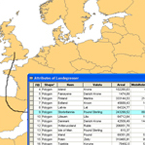
GIS is the bringing together of spatial information with tabular data. Its uses, through data geoprocessing to address particular problems, are multiple. This module presents many examples of forestry applications, and details how GIS allows for better integrated management of various forest-related resources such as timber, biodiversity, water etc. with other social-related uses such as scenic beauty for tourism.
Learning Objectives
After viewing this presentation and relevant support material, users should be able to:
- Define GIS & explain how it is a relational database.
- Differentiate between raster and vector data, and state the advantages & disadvantages of the two types.
- Explain how data is collected and what is done with the collected information.
- Describe applications of GIS at the operational, landscape and global level.
- Describe the relationship between GIS and modeling (e.g. using growth and yield model “FORECAST”).
- Explain how GIS can be used to produce management scenarios for communication with various stakeholder groups.
- Describe a practical application of GIS to the management of visual resources through visual alteration harvesting designs.
Presenter
Listen to Dr. Michael Meitner respond to the question: How did I get interested in this area of study? by clicking on his photo.
For information about Dr. Meitner, please check UBC, Faculty of Forestry
Module Resources
Presentation
![]()
GIS Applications in Forestry
Dr. Mike Meitner explains that GIS is the union of attributes (what) and geometry (where). Data is collected through remote sensing as well as global positioning system (GPS) and field surveys. Applications in forestry are many; a few examples are: Growth and Yield models (FORECAST), Habitat Modeling (SIMFOR) and Forest Visualization wherein a series of visualized 3-D images are derived from GIS data.
Other Resources
- Esri – GIS Company with a number of free online training courses in GIS-related topics.
- Conservation 340 – Course Website has many useful LINKS
Potential Questions for use by Instructors
- What is the relationship between GIS and remote sensing? Why is this especially important for forest management?
- Describe an application of GIS at the operational, the landscape and the global level.
- GIS is an important technology in terms of “the ways in which people engage with spatial information”. Explain what this statement means and illustrate with an example.

